Sudbury
<> Massachusetts
<> More Sudbury Maps
<> Sudbury Historical Society (SHS)
<> Sudbury Archives
<> Hudson 1889
<> History Books
<> Sudbury Population
<> Grant & Boundries
<> Before the English
<> Town Meeting 2020
<> Master Plan 2021
<> History on Nobscot
<> Town Center
<> jch.com/history
<> jch.com
<> YON
Historical Maps of Sudbury
Detailed maps of the whole of Sudbury chronologically: 1795 Mosmon, 1830 Wood, 1856 Walling, 1875 Beers, 1889 Walker, 1894 USGS Topo, 1908 Walker Atlas, 1938 Zoning, 1943 USGS & modern Town Map. The range of time between each map is interesting: 35, 26, 19, 14, 5, 14, 30, 5. . .
Book! Third Edition in 2020 Historical Maps of Sudbury, MA (previous 2nd Edition)
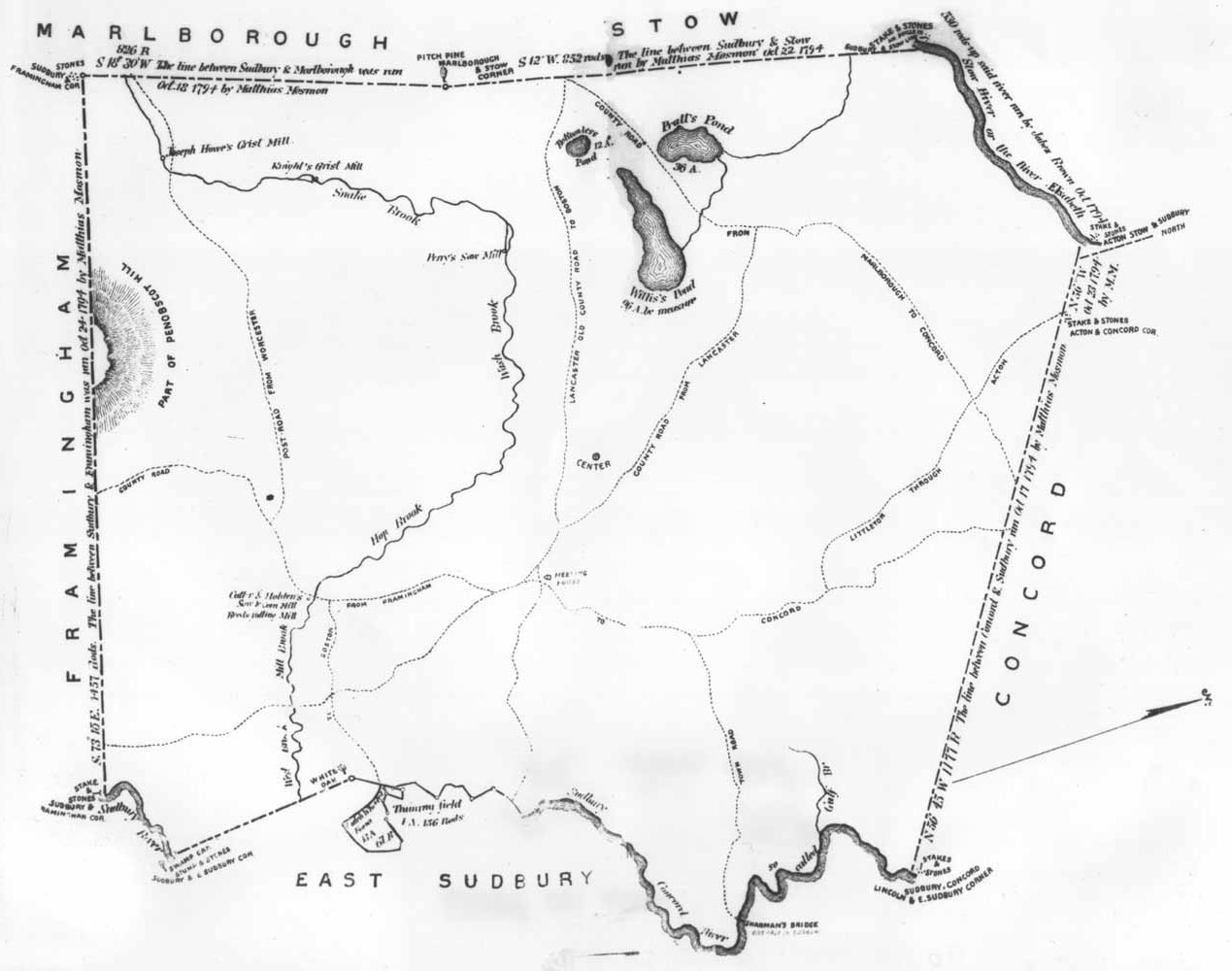
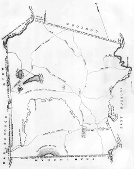 Map of Sudbury drawn by Mathias Mosmon Surveyed in 1794; published in 1795 Described in A.S.Hudson's History, 1889 Hi-Res quality print available from SHS |
|

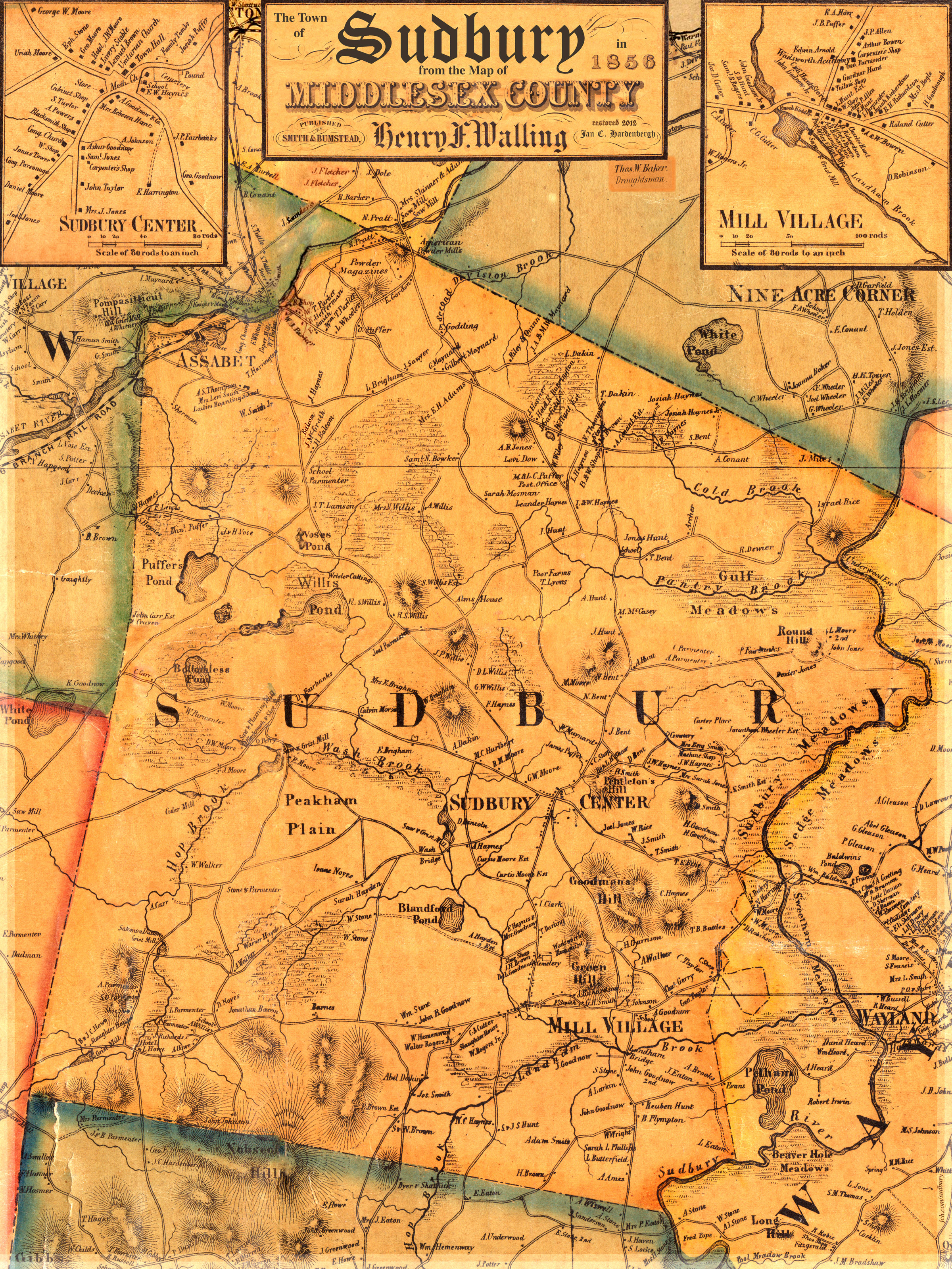
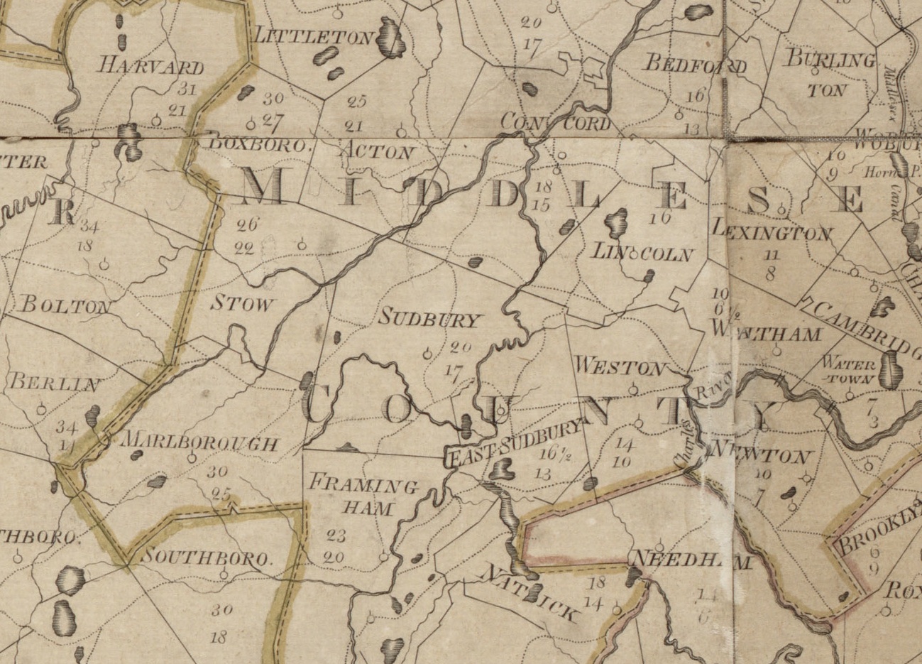
Sudbury in 1856 from Map of Middlesex County
by H.F. Walling's My oddessey with this mapincluding info on Walling and other copies Hi-Res quality print available from SHS
|
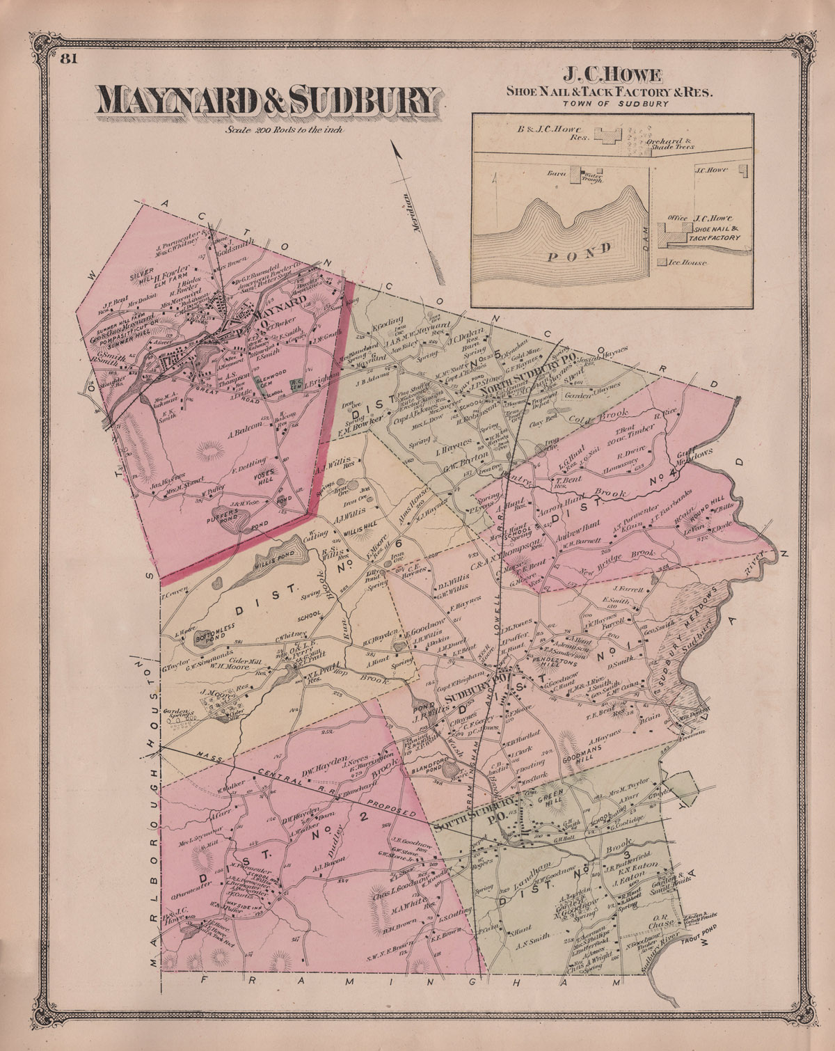
 Sudbury and Maynard, 1875 Beers Atlas of Middlesex County Hi-Res quality print available from SHSmy scans local: 1200, 2400, hi-res |
|
|
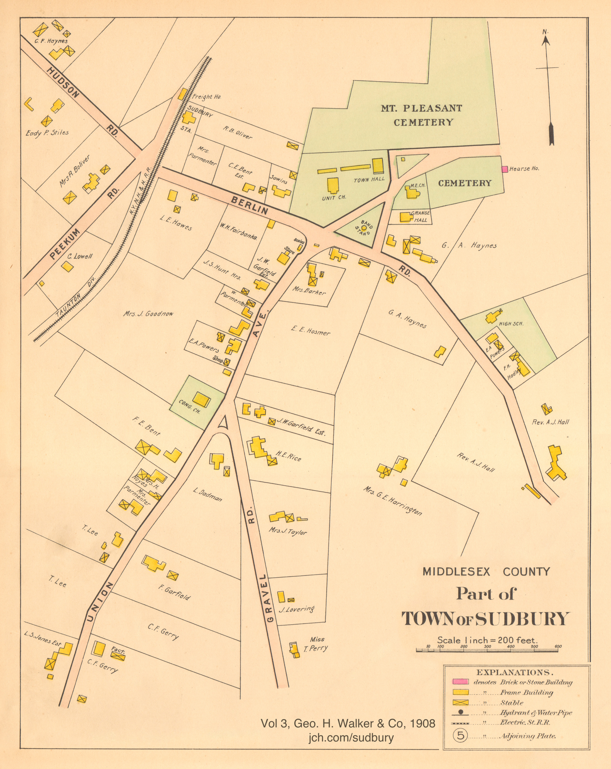
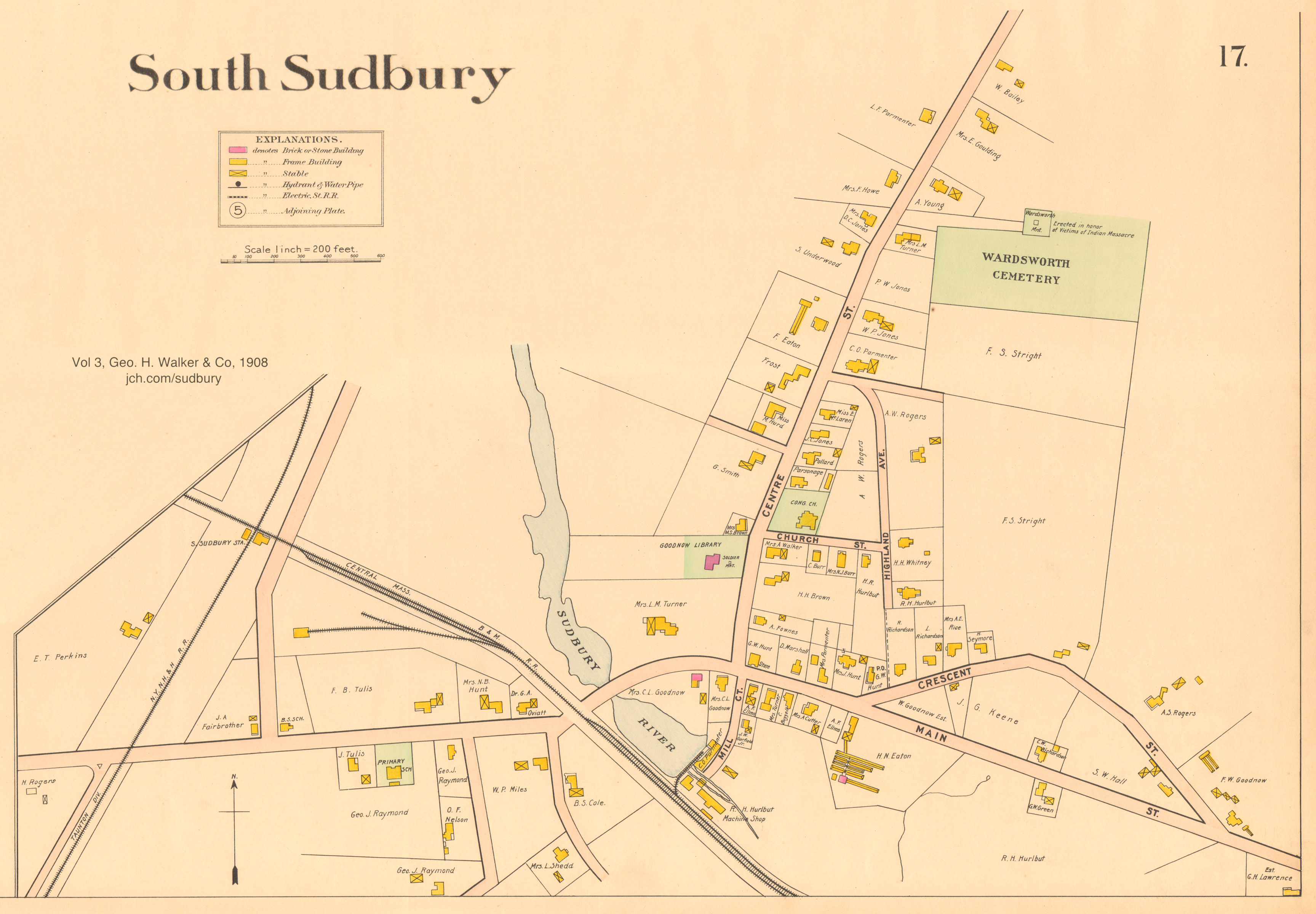
 Atlas of Middlesex County, Vol 3, Geo. H. Walker & Co, 1908 |
|
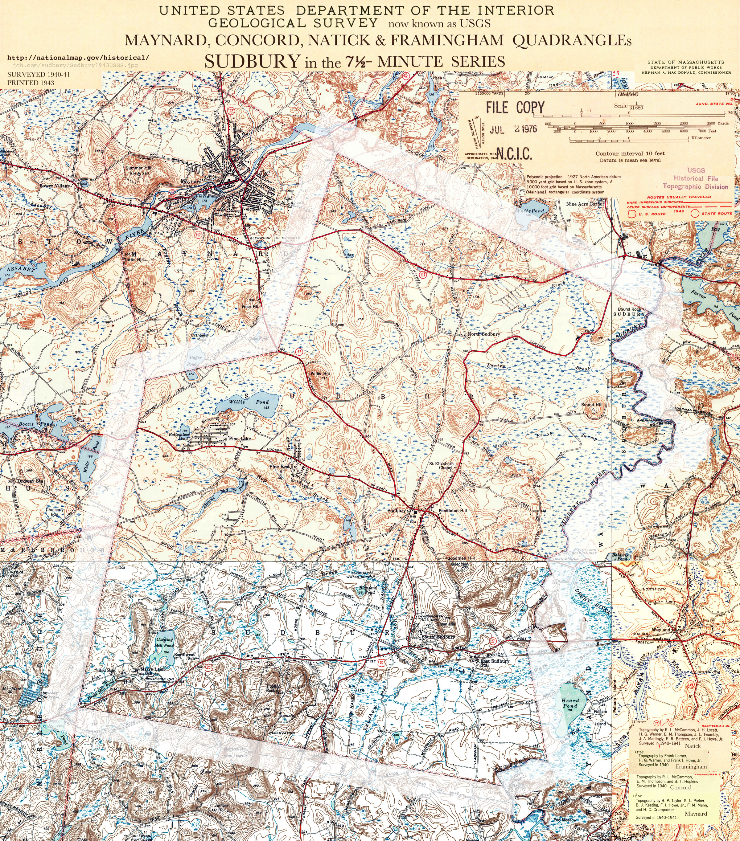
 Sudbury in 1943 USGS 7.5 Minute map (hi-res) |
Town Center Historical Maps
 Town Center inset from Walling 1856 |
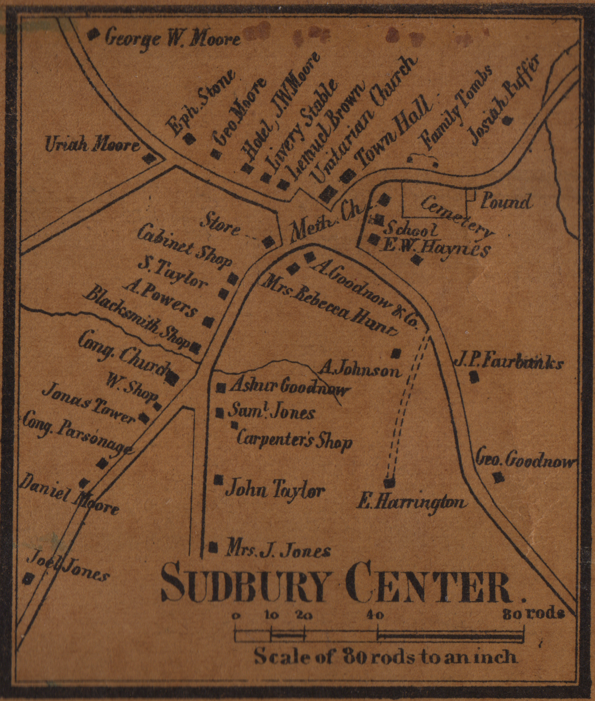
 Sudbury Center 1875 ( page) Beers Atlas of Middlesex County from the collection of Robert A. Maier |
|
|
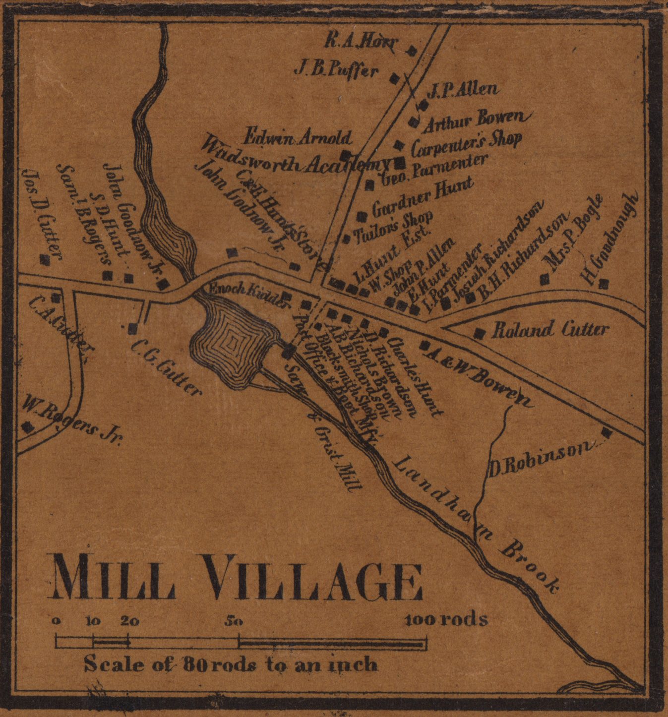
Mill Village / South Sudbury
 Mill Village inset from Walling 1856 |
|
|
|
| |
 Sudbury in Osgood Carleton's Atlas from 1802. The Mosmon map, was created in accordance the 1974 Massachussetts Statute requiring each town to survey its land for this purpose. |
|
|
 Town Of Sudbury 2002 |
Timeline of Early Maps Showing Sudbury:
1677 Foster. A map of New-England, being the first that ever was here cut . . . illustrates King Phillips War. BPL (Sudbury Zoom)
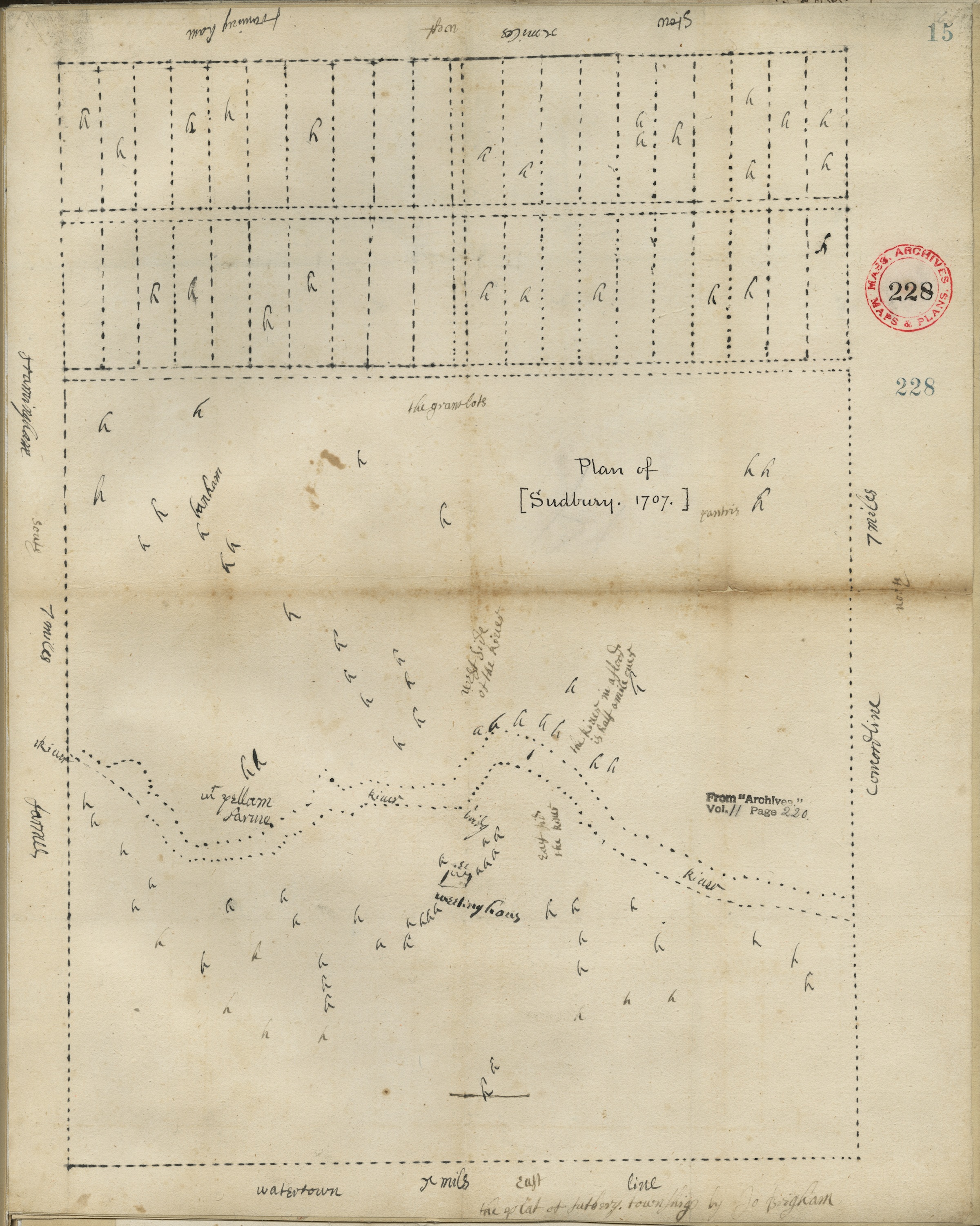
1707 Brigham. the plat of Sudbury Township by Jo Brigham. Shows the river, meetinghouse, lots, "the river in a flood if half a mile over"
1720 Neal, Daniel. A Map of New England According to the Latest Observation. Shows Sudbury as a dot.
1753? William Douglas, Map of New England shows Sudbury as a rectangle. Source: Douglass @ Library of Congress
1755 Jefferys, Thomas, A map of the most inhabited part of New England - Jeffreys at Leventhal/BPL
1759 [Back?] Carte des Possessions des Anglois en Amerique - image Source: Boston Rare Maps
1775 Brown & D'Berniere, Roxbury to Concord, Roads and Distances, spy map! Library Of Congress,
Detail, lo-res (2400X4908)
1785 Accuurate Map of the Four New England States. John Norman, Sudbury and Boston Post Road.
1794 Map of Sudbury drawn by Mathias Mosmon in 1795. High quality print available from Sudbury Historical Society
Is Mathias Mosmon the same person as Sudbury resident and Revolutionary War veteran, Mathias Mosman?
1830 Map of Sudbury drawn by Wm. Wood. High quality print available from Sudbury Historical Society
1856 Map of Middlesex County, Massachusetts, H.F. Walling
1871 Massachusetts Atlas. Walling, H. F.; Gray, Ormando Willis, David Rumsey
1875 Beers: County Atlas of Middlesex Massachusetts 1875 by F.W. Beers & Co. 3 maps: South Sudbury, Sudbury Center and Maynard & Sudbury.
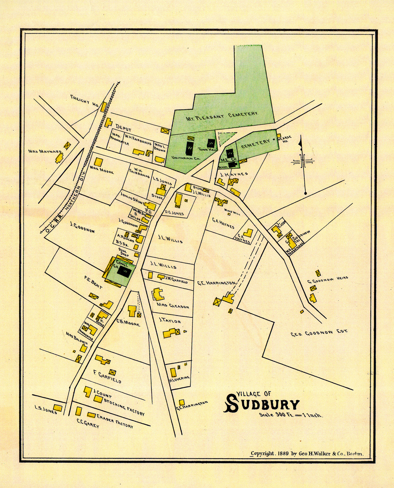
1889 The Atlas of Middlesex County, published by George H. Walker and Co. Sudbury and Maynard, South Sudbury, and Sudbury Center
1891 Topographical Atlas of Massachusetts, Geo. H. Walker & Co. http://www.wardmaps.com/search.php?city=sudbury
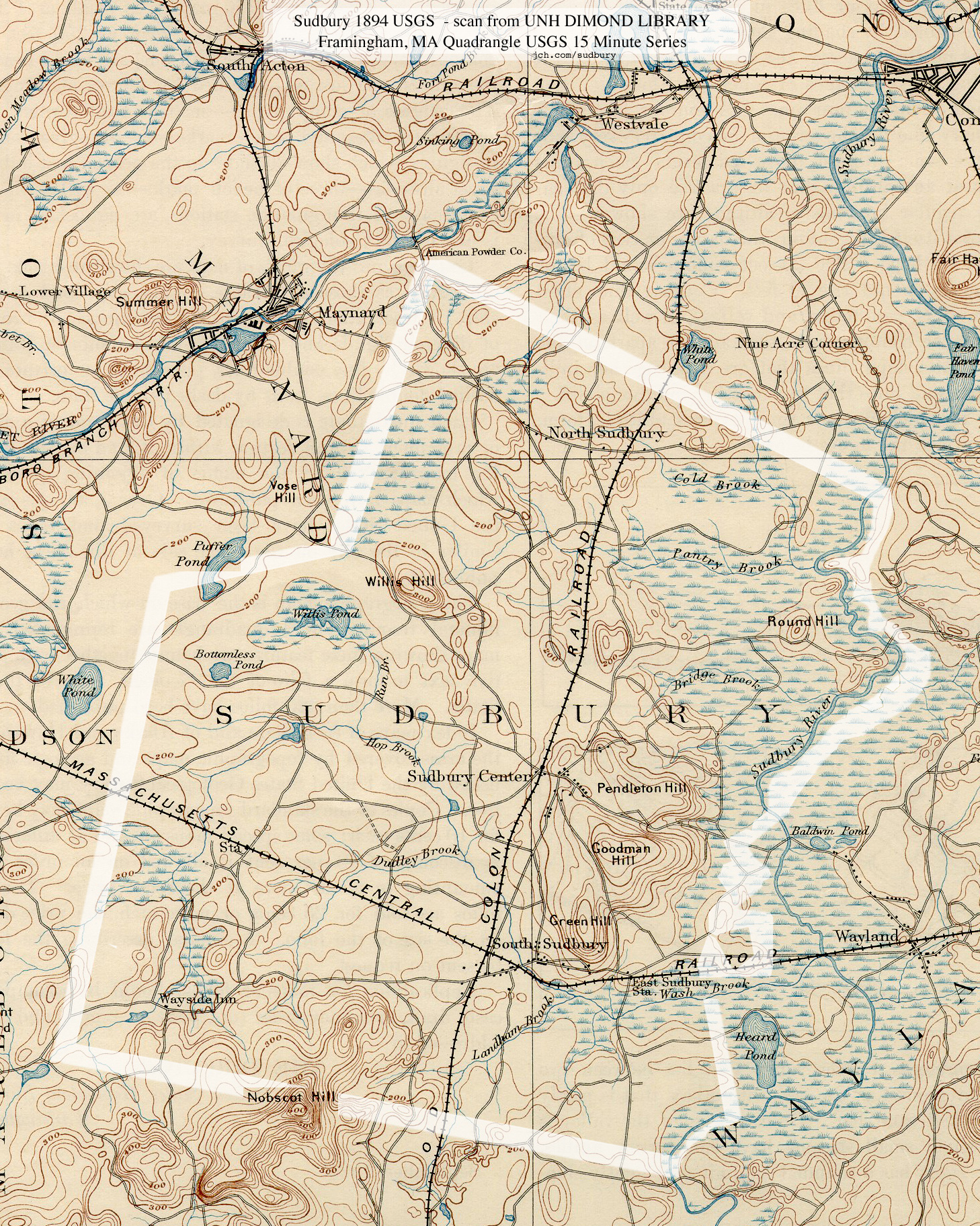
1894 USGS Topo 1894 USGS Map host by UNH Dimond Library. Now available from USGS
1908 Atlas of Middlesex County (Boston: Geo. H. Walker & Co, 1908), vol. 3. (There are other years that the Walker Atlas was published, 1998 & 1900)
Reconstructed Maps:
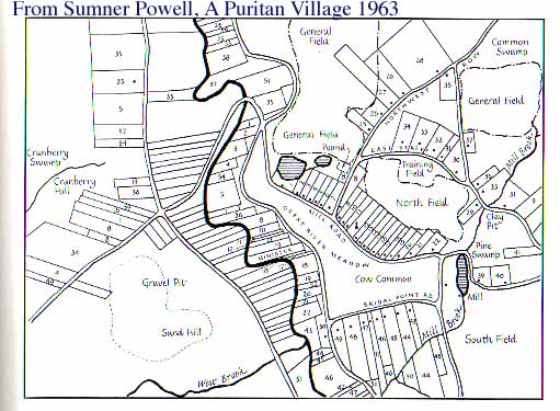
Left) Original Town Layout as found in 1963 book: Puritan Village: The Formation of a New England Town, Sumner Chilton Powell
Mid Left) Map Of Sudbury 1676, places relevant to the Sudbury Fight of King Philips War
Middle) Sudbury, Then and Now, Charles Way, Architect, 1932 Town Hall, for Sudbury 300th Anniversary, 1939
Right) Map showing land grants that formed Sudbury, from SHS book 1639 - 1939, originally a WPA book. These are low res because I do not have permission to use, so, these are just teasers...
Links:
Community Heritage Maps Originals and reprints of Sudbury Maps
Ward Maps with originals and reprints of Sudbury Maps
Maps from Sudbury Historical Socierty
The Sudbury Archives is a COOL site that gets cooler all the time!
Town Archives' Historic Map Page - not updated in a while
More Sudbury Maps including: 1930 Bay Circuit Trail with Nobscot and Wayside Inn. SVT Nobscot Map, 2008
Small versions of many of these maps are found in A Pictorial History, Laura Scott, 208 pages, The Donning Co., 1989
Notes:
On Nov 5, 2010, at 5:48 PM, Sudbury Historical Society Email wrote:
Then and Now map was designed & produced by Charles Way the Architect of the new 1932 Sudbury Town Hall, to commemorate the 300th Anniversary of the Town in 1939. According to news articles I have read about the Celebration. The original found its way to the Newton/Waltham bank (I think that was the name) where Pendleton's was for a short time at Mill Village. Dr. Bob M. got it from there, and it is as you photographed it on his wall. It is in color, it appears to be hand colored or painted, whereas all the copies I have seen were blue print type copies (blue on a white background) as we have in our Collection.
You have only a small section of the 1650 Map of Sudbury, that Sumner Chilton Powell had made for his book 'Puritan Village'. One of our SHS members in Rhode Island, collected & read every edition of Puritan Village that was printed while Powell was alive. Powell kept updating his foreword, and in one he stated that he gave the SHS his Maps. Ms. Caroline Miller called from R.I., and came up to look at them, and we discovered that because Forrest Bradshaw (late Town Historian) had written his initials on them, they were in his Collection.
Chuck Z. (our Tech man, whom you have met) then photographed them, and using I believe a GPS maps joined Sudbury & Wayland, and printed it, then made overlays of Powell's maps, so a founding family could find their ancestral plot or plots (from a list drawn up by Powell of the Landholders with a #) as of Sudbury circa 1650. Every founding family visiting, that has made use of the Map & overlays has wanted a reproduction of them, but they are very small (8"x10") and it is very hard to see the #s on the overlays. In talking with the publisher of Puritan Village, they expressed an interest in working with us to create a CD or DVD of the combined Map with digital overlays, that they would sell.
From: "YON - Jan C. Hardenbergh"
Date: Tue, 20 Dec 2011 01:07:10 -0500
To: Michael Buehler
Subject: Advice on scanning Walling's 1856 Middlesex County map
First, Thank You so much for writing Henry F. Walling and the Mapping of New England's Towns, 1849-1857 By Michael Buehler (PDF)
http://www.bostonraremaps.com/pdf/portolan%20spring08%20article%20reprint.pdf
On Dec 21, 2011, at 6:50 AM, Michael Buehler wrote:
--I don't have much to add about other maps of Sudbury, but:
--If you haven't already seen it, the 1830 printed Wood is based on a manuscript that is almost certainly held at the Mass. State Archives. It is likely that there are also 1 or more copies of the manuscript somewhere in town. For more information about the context of this map, see the article Early Plans of Massachusetts Towns on page 2 of one of my newsletters:
--I don't know a lot about the Walker firm, but I have handled piles of bird's-eye views produced by the firm. For a brief history of that firm, see Pierce and Slautterback's "Boston Lithography," p. 159. I don't care much for their maps, but they put out a large number of quite lovely chromolithographic views, of Boston, the White Mountains, Mt. Washington, Casco Bay, etc., etc.
For future reference, I am always interested in buying early, rare and interesting American maps. I handle lots of different kinds of material, but among other things would always be interested in early (pre-1860) maps of New England towns. For instance, the Wood map of Sudbury is very, very rare, and if you ever knew of a copy for sale I would likely jump at it.
Michael Buehler, www.bostonraremaps.com
Boston Rare Maps,
88 High Street,
Southampton, MA 01073
started April 23, 2005 <> last update 2023-09-06 to add jch.com/history <> YON


